Risk type: nodata/ignored
These 23 cases exercise the nodata/ignored failure mode. Run your function against all of them to check how it behaves.
Use GeoCase in your tests
Install the complete set of vector, raster, and NetCDF dependencies:
 Bottom-Up DEM (Positive Y Resolution)
 COG Multispectral Small
 DEM NaN NoData Small
 DEM Small
 GeoTIFF Float64 Small
 GeoTIFF Int16 Small
 GeoTIFF Int32 Small
 GeoTIFF Int8 Small
 GeoTIFF Multi-Band Small
 GeoTIFF NoData Small
 Hole Center NoData Raster
 Land Cover With Ambiguous Zero
 Multispectral Sentinel-2-like Small
 NDVI Scaled Int16 Small
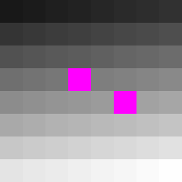 Nodata Only (One Sentinel, North-Up, Unrotated)
 Overlap Group -- Centre
 Overlap Group -- North
 Overlap Group -- South
 Pixel-Is-Area DEM
 Pixel-Is-Point DEM
 Water Mask Small
| Case | Category | Format | Geometry |
|---|---|---|---|
| Bottom-Up DEM (Positive Y Resolution) | raster | GeoTIFF | -- |
| COG Multispectral Small | raster | GeoTIFF | -- |
| DEM NaN NoData Small | raster | GeoTIFF | -- |
| DEM Small | raster | GeoTIFF | -- |
| GeoTIFF Float64 Small | raster | GeoTIFF | -- |
| GeoTIFF Int16 Small | raster | GeoTIFF | -- |
| GeoTIFF Int32 Small | raster | GeoTIFF | -- |
| GeoTIFF Int8 Small | raster | GeoTIFF | -- |
| GeoTIFF Multi-Band Small | raster | GeoTIFF | -- |
| GeoTIFF NoData Small | raster | GeoTIFF | -- |
| Hole Center NoData Raster | raster | GeoTIFF | -- |
| Land Cover With Ambiguous Zero | raster | GeoTIFF | -- |
| Lat/Lon Small NetCDF | netcdf | NetCDF | -- |
| Multispectral Sentinel-2-like Small | raster | GeoTIFF | -- |
| Packed int16 NDVI (NetCDF) | netcdf | NetCDF | -- |
| NDVI Scaled Int16 Small | raster | GeoTIFF | -- |
| Nodata Only (One Sentinel, North-Up, Unrotated) | raster | GeoTIFF | -- |
| Overlap Group -- Centre | raster | GeoTIFF | -- |
| Overlap Group -- North | raster | GeoTIFF | -- |
| Overlap Group -- South | raster | GeoTIFF | -- |
| Pixel-Is-Area DEM | raster | GeoTIFF | -- |
| Pixel-Is-Point DEM | raster | GeoTIFF | -- |
| Water Mask Small | raster | GeoTIFF | -- |