Multispectral Mixed Resolution Small
rasterGeoTIFFEPSG:32633tinybundled
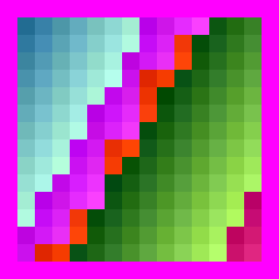
A tiny three-band uint16 Sentinel-2 L2A stack (B04, B08, B11) on a common 10 m grid, where B11 is 20 m-native and carried as 2x2 block-replicated values — so the resolution mismatch exists in the pixels, not only in the metadata. Baseline 04.00 radiometry as in multispectral_s2_like_small.
| Property | Value |
|---|---|
| Case ID | multispectral_mixed_resolution_small |
| Category | raster |
| Format | GeoTIFF |
| CRS | EPSG:32633 |
| Location | Southern Italy / Sicily (synthetic, UTM 33N) — 15.00°E, 40.65°N → 15.00°E, 40.65°N |
| Test tier | integration |
| Size class | tiny |
| Storage class | bundled |
| Redistributable | yes |
| Loader | rasterio |
| Status | validated |
Use this case
import pytest


@pytest.mark.geocase_case("multispectral_mixed_resolution_small")
def test_multispectral_mixed_resolution_small(geocase_case) -> None:
    data = geocase_case.load()
    assert data is not None
Use GeoCase in your tests
Install the complete set of vector, raster, and NetCDF dependencies:
What this case checks
Confirm GeoCase preserves a multispectral stack assembled from bands of differing native resolutions resampled to a common grid.
Risk types covered
band/losstransform/resampling_assumptionstransform/resolution_mismatch
Expected behavior
| Assertion | Expected |
|---|---|
expect_loadable |
yes |
expect_crs |
yes |
expected_epsg |
32633 |
expect_nodata |
yes |
expected_band_count |
3 |
expected_dtype |
uint16 |
expected_shape |
[16, 16] |
expected_nodata_value |
0 |
nodata_convention |
sentinel |
expected_compression |
deflate |
expected_band_names |
B04, B08, B11 |
expected_scale_factor |
0.0001 |
Known answer
Computed from the actual bytes and gated against them. Grade your own output against these.
| Quantity | Value |
|---|---|
| Mean over valid pixels | 4119.0476190476 |
| Mean including NoData | 3153.6458333333 |
| NoData pixels | 180 |
| Bounds (case CRS) | [500000.0, 4499840.0, 500160.0, 4500000.0] |
Required capabilities
loadmultiband-read
Files
Source and license
- Source: geocase-synthetic
- License: MIT
Tags
delivery:resampled-stack geography:utm geotiff mixed-resolution multispectral product:multispectral raster
Related cases
- Multispectral Sentinel-2-like Small --
multispectral_s2_like_small - COG Multispectral Small --
cog_multispectral_small - Optical RGB Small --
optical_rgb_small - SAR Dual-Pol Small --
sar_dualpol_small - SAR VV Small --
sar_vv_small